
FORECAST HIGHLIGHTS
- NEXT WEEK: The heat sticks around. Above-average temperatures will continue through much of next week, with only limited rain chances.
- RAIN: Sea-breeze showers and thunderstorms are possible
- PATTERN CHANGE: We’re not seeing a dramatic change, but maybe we could be a few degrees cooler.
Watch our Live Radar here.
FORECAST
TOMORROW
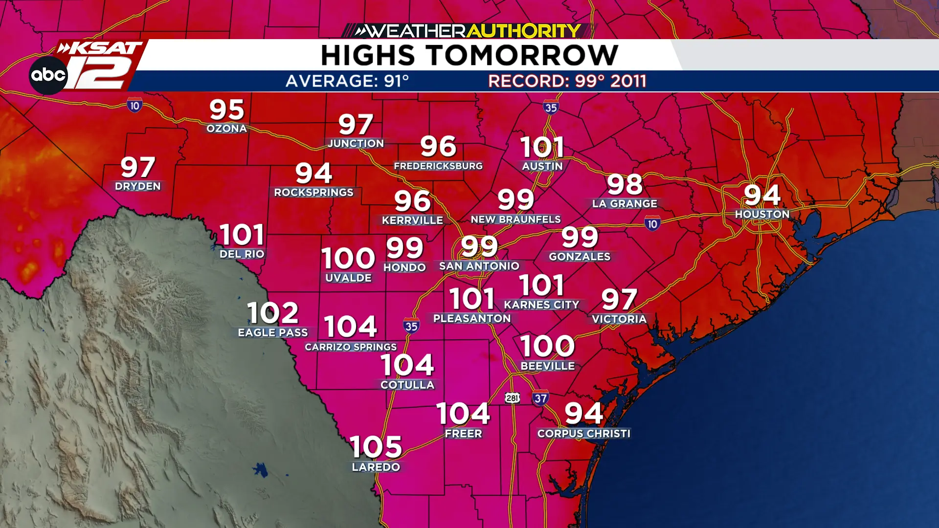
Summer heat is still sticking with us as we near the halfway point of September. We’ll be just under 100 degrees in San Antonio. A heat advisory is in effect for Bexar County and all counties along northern I-35 and within the Coastal Plains. Temperatures could reach as high as 104 degrees, while the heat index could reach 110+ degrees.
THIS WEEK
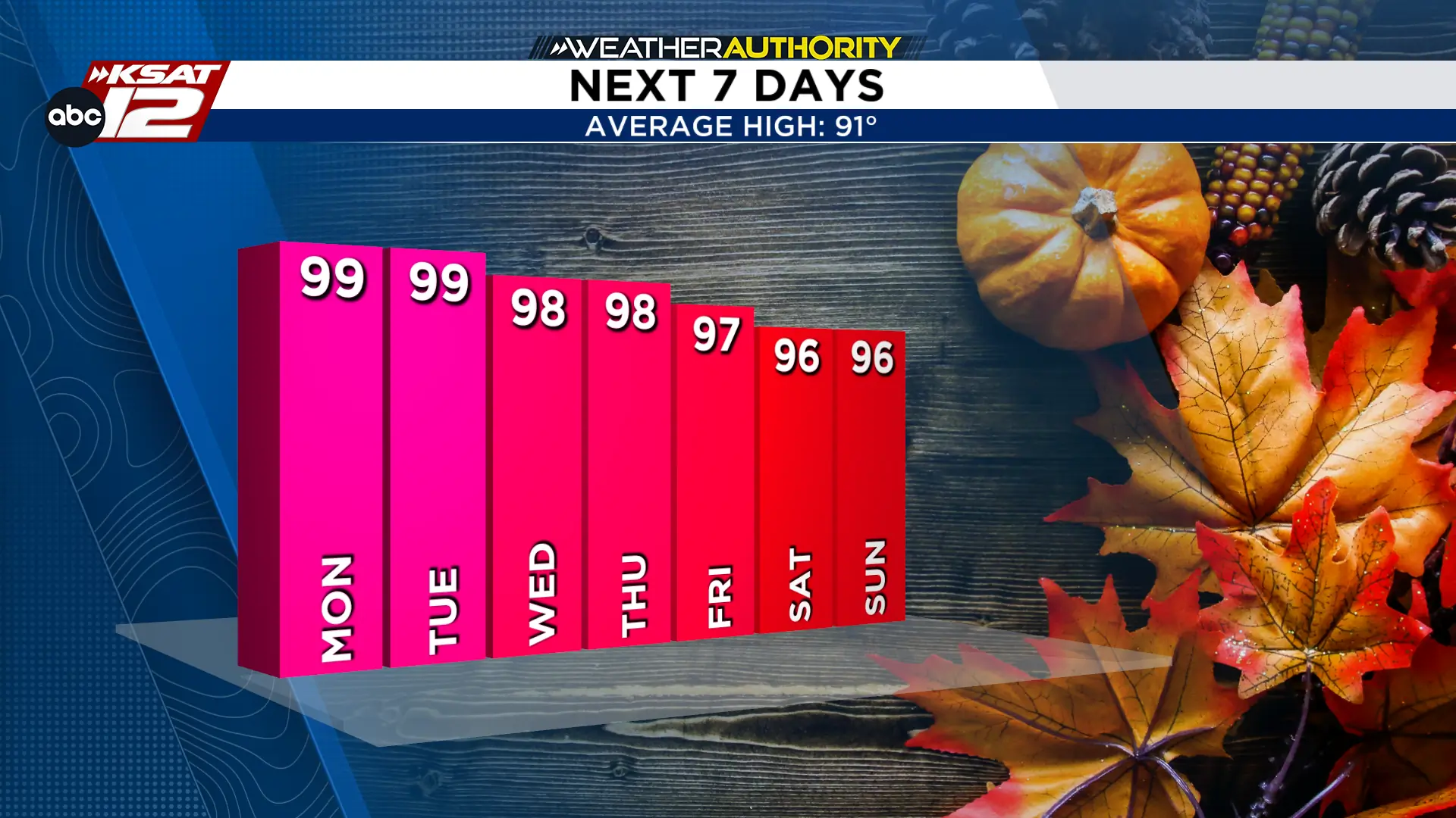
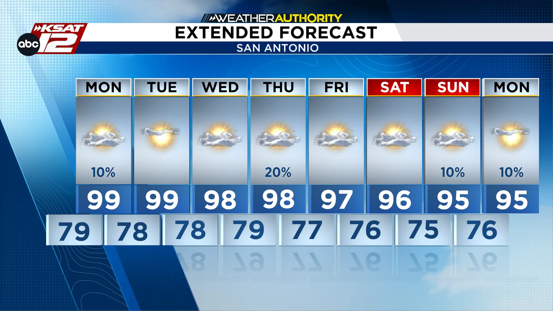
Unfortunately, cooler weather isn’t showing up anytime soon. Very little change is expected Monday as High pressure will continue to dominate the region, maintaining a pattern of hot, mostly dry weather. High temperatures should stay in the mid-90s to just above 100° each afternoon. NOT FALL-LIKE AT ALL!
The Coastal Plains will have the best chance for rain. Nearly daily sea-breeze showers and isolated thunderstorms will be possible during the afternoon and evening. Most inland areas will likely remain dry.
A POTENTIAL PATTERN CHANGE?
There may finally be some hope toward the end of NEXT WEEKEND. Forecast models are hinting at a possible pattern shift that could help keep temperatures below 100° and increase rain chances across the region. However, there is still plenty of inconsistencies. For now, the heat remains dominant, but this is something we’ll be watching very closely.

KSAT meteorologists keep you on top of the ever-changing South Texas weather.
QUICK WEATHER LINKS
- Download FREE KSAT Weather Authority App: Up-to-date forecast information and livestreams from trusted local meteorologists.
- KSAT Connect: Share your weather photos.

