
FORECAST HIGHLIGHTS
- THIS EVENING: A few isolated evening storms possible in the Hill Country and southern Edwards Plateau.
- MONDAY: Continued heat with highs just under 100°. Evening storms are possible.
- FIRST PART OF WEEK: Mid 90s with isolated rain chances around 10%-30%.
FORECAST
REST OF TODAY
Isolated evening storms are possible in the Hill Country and southern Edwards Plateau. Rain chances remain at 30% into the early morning hours of Monday. While severe weather is not expected, any storms could bring gusty winds, localized heavy rain, and potentially small hail.
MORE RAIN CHANCES
A stalling front and lingering moisture may spark isolated showers or storms Monday afternoon and evening, with scattered activity redeveloping through Wednesday. Rain chances are capped at 20- 30%, but most areas will remain dry.
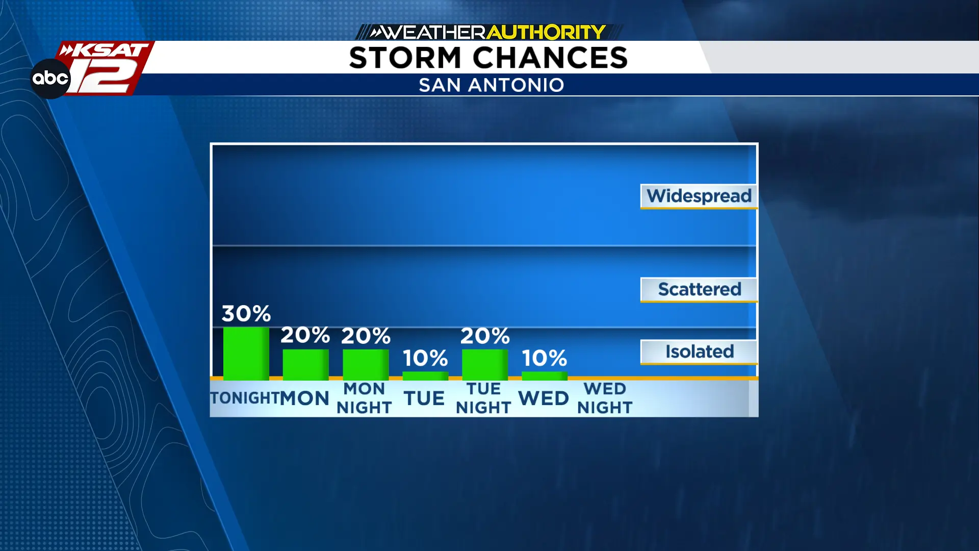
MONDAY
Our week start mostly pleasant with mostly clear to partly cloudy skies on Monday. High will reach the mid-90s but heat indices will peak near 100 or even top 100 for a few areas. Rain activity will start late Monday evening. This activity will develop or move into Hill Country areas first. Timing of this activity is likely to begin around 4 PM with development growing during the evening. Severe weather is not expected to develop.
THIS WEEK
High pressure rebuilds over South Central Texas by Tuesday. This will keep conditions hot and mostly dry through the week. Spotty rain chances stick around through Wednesday, followed by a *slight* cooling trend later in the week with highs in the low-to-mid 90s. High temperatures will continue to remain above average, but drier air may bring cooler nights by the weekend.
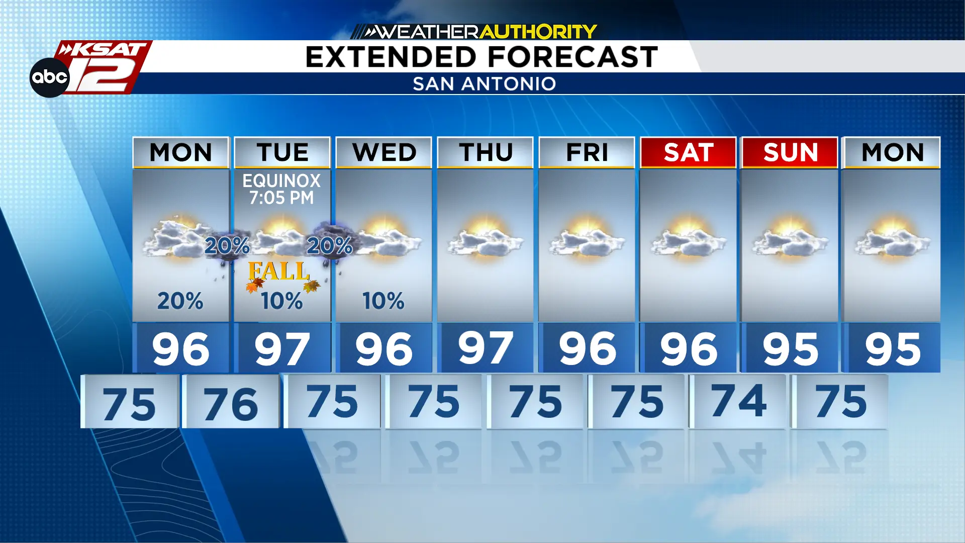

KSAT meteorologists keep you on top of the ever-changing South Texas weather.
QUICK WEATHER LINKS
- Download FREE KSAT Weather Authority App: Up-to-date forecast information and livestreams from trusted local meteorologists.
- KSAT Connect: Share your weather photos.

