

FORECAST HIGHLIGHTS
- SUNDAY: Hitting 103° again in San Antonio.
- HEAT ALERT: Heat Advisories continue for portions of the region.
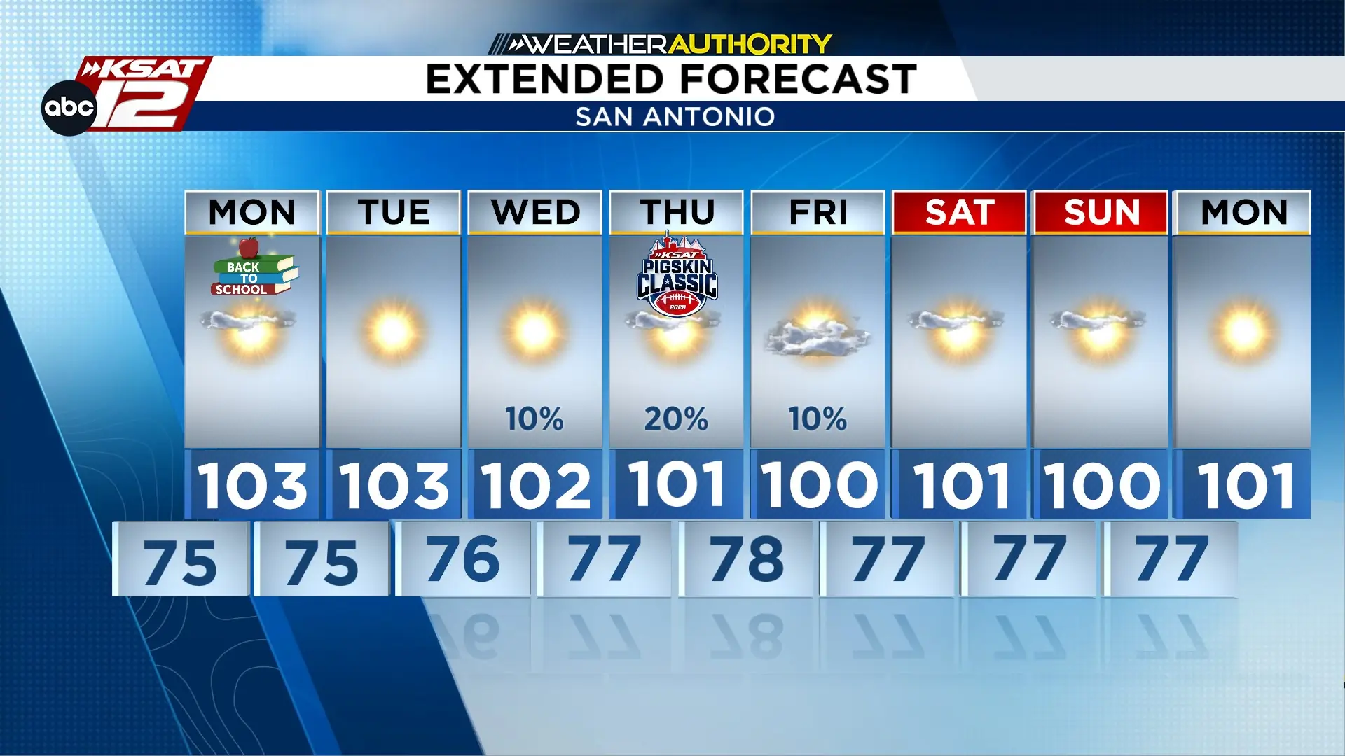
- WEEK AHEAD: Little change expected with 100°+ temperatures and limited rain chances through midweek.
FORECAST
MORE TRIPLE DIGIT HEAT THIS WEEK

An Extreme Heat Warning is in effect until 7 p.m. Monday for Travis and Bastrop counties, with highs up to 107° and heat indices reaching 110°. A Heat Advisory follows from 7 p.m. Sunday through 7 p.m. Wednesday including Bexar County, with temperatures up to 105°. Residents should take precautions to avoid heat-related illness.
THE HEAT ISN’T LEAVING ANYTIME SOON
High pressure will keep South Central Texas hot and dry through at least Wednesday. With temperatures remaining above 100 degrees, the August heat wave will persist across San Antonio and the surrounding region.
Residents should drink plenty of fluids, stay in air-conditioned rooms when possible, avoid prolonged exposure to the sun, and limit strenuous outdoor activities to the early morning or evening. Anyone working outdoors should take frequent breaks in shaded or air-conditioned areas and watch for signs of heat exhaustion or heat stroke. Heat stroke is a medical emergency.
IS THERE ANY BREAK IN SIGHT FROM THE HEAT?
While the upper-level ridge may shift toward Arizona by Thursday or Friday, offering a slight chance for isolated showers or thunderstorms, rain probabilities remain low. If we are lucky enough to see rain in the area, it is unlikely to provide a significant or lasting reprieve from the ongoing heat.


KSAT meteorologists keep you on top of the ever-changing South Texas weather.
QUICK WEATHER LINKS
- Download FREE KSAT Weather Authority App: Up-to-date forecast information and livestreams from trusted local meteorologists.
- KSAT Connect: Share your weather photos.

