Extended forecast. (Copyright 2026 by KSAT - All rights reserved.)
FORECAST HIGHLIGHTS
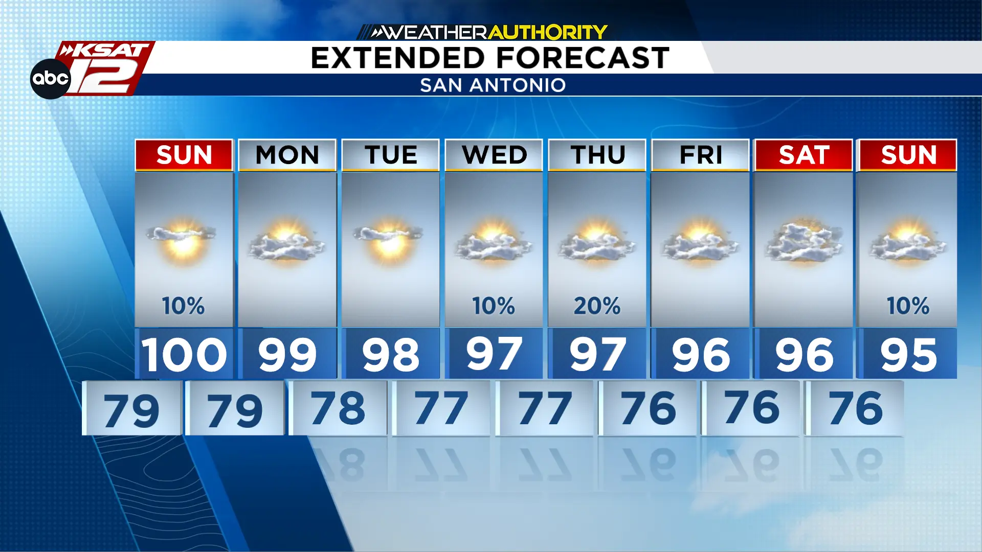
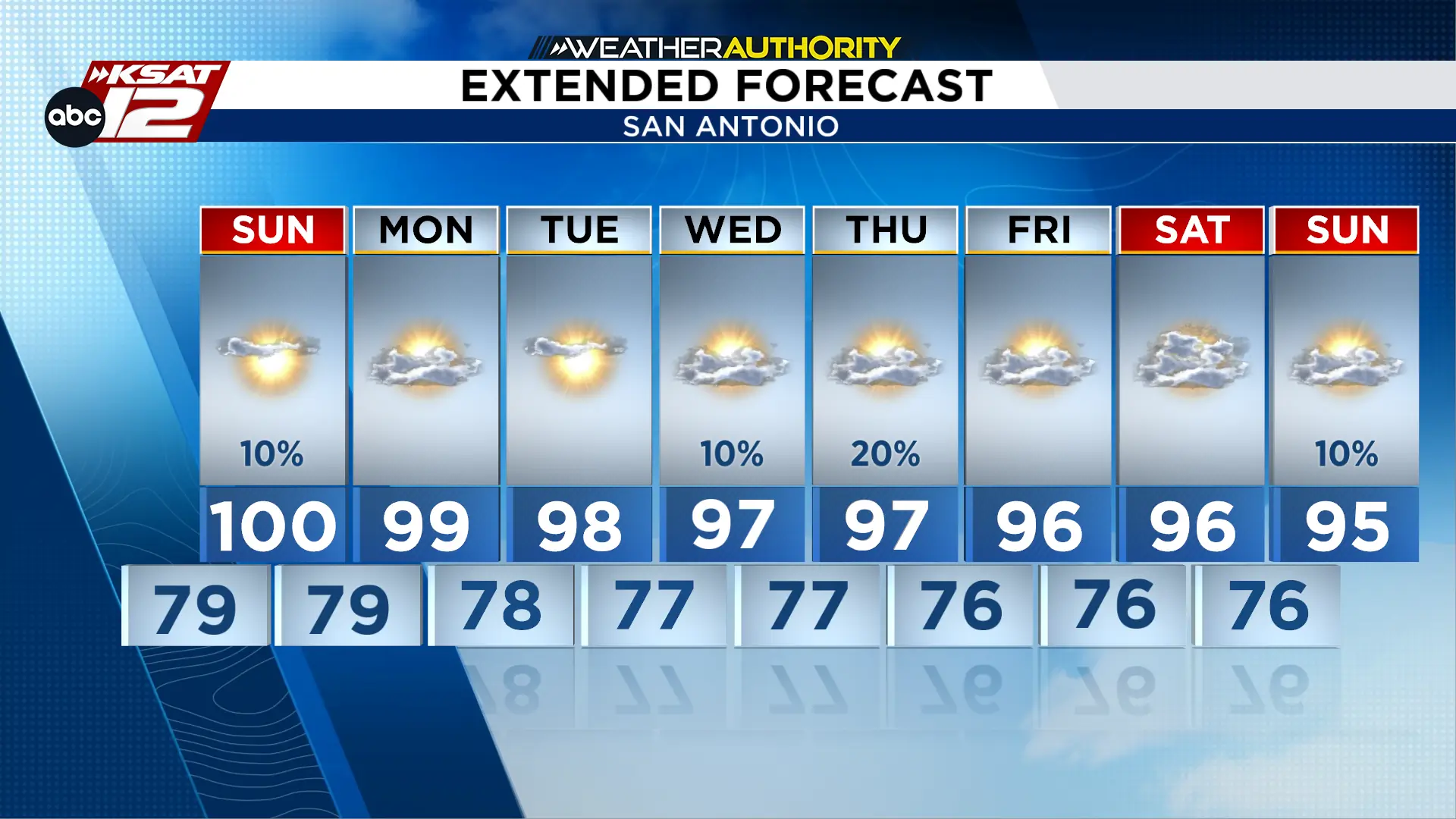
HEAT: Very hot conditions continue, with highs ranging 98° to near 100°.
WEEKEND: Near-record heat possible, with some areas approaching 100° or higher.
NEXT WEEK: The heat sticks around, with above-average temperatures continuing.
FORECAST
SUNDAY
Sunday afternoon rain chances. (Copyright 2026 by KSAT - All rights reserved.)
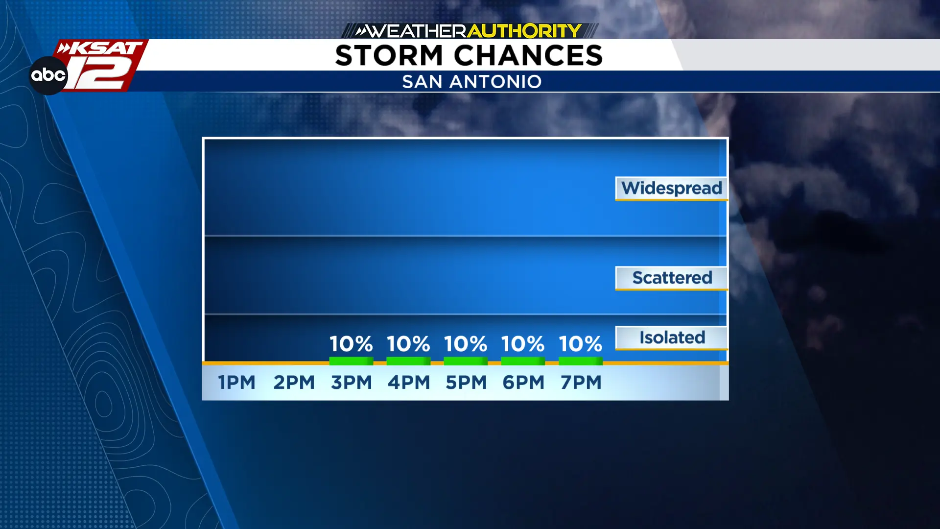
Sunday will still be very hot, though our high temperatures could back off a degree. Heat index values could again approach advisory levels, particularly east of I-35 toward the Coastal Plains. Spotty showers will be possible along the coast for most of Sunday. A storm or two could travel farther inland towards San Antonio between 3pm and 7pm.
NEXT WEEK
Unfortunately, cooler weather isn’t showing up anytime soon. High pressure will remain in control through much of next week, keeping skies mostly dry and temperatures well above average. A few late-afternoon showers or thunderstorms will remain possible near the Coastal Plains, but most locations should stay dry.
There’s a chance a cold front could be on the horizon, but we’re not seeing any convincing signals just yet. Trust us, we’re looking really hard for a break from this heat.
Extended forecast. (Copyright 2026 by KSAT - All rights reserved.)
Daily Forecast
KSAT meteorologists keep you on top of the ever-changing South Texas weather.
Shelby Ebertowski joined KSAT 12 News in January 2025. She came to San Antonio from Fargo, North Dakota via the University of North Dakota, where she learned the ropes as a weekend forecaster over two years at KVLY. Her love of weather love began after experiencing Hurricane Harvey in 2017.